Today is Wednesday January 24, 2007.
I left the Rocky Springs Campground to see just what is happening with the Memphis In Our Own Voice Training because I was to hear from them and I haven't. I stop by where the cell phone tower is that the guy tells me about. I get a nice strong cell phone signal (5 bars), wait 15 minutes to see if any messages are going to drop in and none do. Wierd I say to myself. Where I am going to try to end up is less than 70 miles down the road and it is barely noon. I decide to look at some more sites along the way and enjoy some more scenery.
It's a nice day. I don't have to wear a snow suit. I am a little chilly, but not really cold. I could be warmer, but only truly love to ride with the visor flipped up. Oops, gotta get offline for a minute and load the pics into the computer. There is one with me in my new tent that will give you a laugh. Paul and Wendy have another pic that I will add in when they give it to me.

Here's the pic that I have of me in the new tent with my stuff all around me.
Catch ya in a few.
Ok, I am back and as you can see I have inserted the picture.
The first place that I stop is at the Lower Choctoaw Boundry Line. the first sign says:
Red Bluff Stand
John Gregg at the lower Choctaw Line respectfully informs the public and travellers particulary, that he keeps constantly on hand a large and general supply of GROCERIES, ground Coffee ready to put up, Sugar Biscuit, Cheese, Dried Beef, or Bacon, and every other article necessry for the accomodation of travellers going through the nation on very reasonable terms. He is also prepared to shoe horses on the shortest notice.
Established in 1802 this hostelry on teh Indian Boundry was the last place a northbound traveller could get provisions.

now in the part of Michigan I was living in, all county lines and all territorial lines seemed to be thoroughly surveyed. I found the following sign fairly amusing because of the difference in cultures. We would probably tear down the trees to put in a tiny surveyor's stake. I am very able to appreciate the difference.
Lower Choctaw Boundary
The line of trees to your left has been a boundary for 200 yeras. It was established in 1765 and marked the eastern limists of teh Old Natchez District. This boundary ran from a point 12 miles east of Vicksburg southward to the 31st parallel.
First surveyed in 1778, it ws reaffirmed by Spain in 1793, and by the United States in 1801.
Since 1820, it has served as the boundary between Hinds and Claiborn Counties, Mississippi.

There seems to be no trail to walk down and to my undiscerning eye, it looks lider there are lines of trees everywhere. sigh But here's a pic on the sign. grin

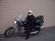
Here is the Kawasaki sitting in the layby of the Lower Choctaw Boundary.

Nest up is Deans Stand. Here's what the sign says:
The Treaty of Doaks Stand, 1820 opened this land to white settlement. Land was quicly claimed and pioneer families established themselves in this wilderness. Willean Dean and his wife Margaret settled near here on the Old Natchez Trace in 1823.
The Deans supplemented their farm income by offereing lodging to travelers. The clientele was a cross section of the advancing frontier--the homeward bound boatman, the hurrying mail rider, the trader in land and basics, the fugitive, or the ininerant preacher.
On the night of May 12, 1863, General US Grant made his headquarters here after the Battle of Raymond.

I got tired of having the Kawasaki in the pics more than I was, so I tried to take a pic of myself.

Here's the bike at Dean's Stand. I couldn't get both of us in one pic. (I tried, really i did.)

As I ride along, I start to think more and more about how wierd the cell phone thing is. It was frustrating as I can't get Verizon and have tried off and on more than 30 times.

Now we are at the Battle of Raymond:
By the time of the Civil War, the Natchez Trace had lost its signifiance as a national road. One of the sections ran from Port gibson toward jackson but the route veered from teh original Trace to reach Raymond. In the spring of 1863, General U S Grant marched his Union Army over this route after crossing the Mississippi and taking Port Gibson.
On May 8, Grants forces drew fire from a Confederate Brigade, commanded by Brigadere General John Gregg, located on the southern edge of Raymond, three miles east of here. After a day of bitter fighting the confederates withdrew towards Jackson, leaving their wounded in the county courthouse.This convinced Grant of the need to take Jackson in order to ensure success of his forthcoming siege of Vicksburg.

vv
Do you belive that all that stuff in the tent actually fits on this bike? grin I continue on up the road into Clinton, grab some gas and drop by a Wendy's to eat and warm up. About the itme I start on the sour cream and chive baked potato my phone starts to ring and ring.
People are telling me that they have left me many messages, but I am showing none of them. After making some arrangements, I start to eat my cold baked potato and some of my chicken nuggets. All of a sudden my phone starts beeping like crazy that I hae messages. There are over 25, with 9 of them being about business. Grrr. I will have to call a lot of people and apologize. It's frustrating because I even tried to call my voicemail.
I talk to Verizon and voice my dismay. I can't even proactively call my voicemail. What's up with that?
I start calling people back and making plans. I find that I am going to need to leave a day early and the person I was planning on leaving my bike with is gone. I ask her if she can think of a way to find another place to keep my bike. I had wanted to visit with her for a bit also. Get my head screwed on a little straighter as she has had to deal with the Verizon Cell Phone glitch for a while and I hoped that she had found an answer.
I decide to find a hotel room so I can wash some stuff and figure out a way to get things to work.
What occurs to me is that I am having a love affair with Mississippi. I am so enjoying it here. I smile and think about that for a bit. And think about sending my snow suit home. Yeah!


 Here is the bear wearing little Ruby Slippers.


 The scarecrow (above) and the tinman (below) are also absolutely awesome.
 We are cruising down the road and I was asked if I was hungry or not and I said that I could go either way and was told there was a great place for Po'Boys just down the road and then was asked if I had ever eaten a po'boy. I said no, what were they?
 m
m


 mI understand that a lady on the news said that things that look like that are caused by the heat from jet planes.


 now in the part of Michigan I was living in, all county lines and all territorial lines seemed to be thoroughly surveyed. I found the following sign fairly amusing because of the difference in cultures. We would probably tear down the trees to put in a tiny surveyor's stake. I am very able to appreciate the difference.


 I continue on up the road into Clinton, grab some gas and drop by a Wendy's to eat and warm up. About the itme I start on the sour cream and chive baked potato my phone starts to ring and ring.